
Though people are typically exposed to only a few types of maps — like a political, physical, topographical, or road map — there are many more interesting varieties. With regard to California, these three maps are worth having a look at.
3 California maps
1. Island map
When Europeans were exploring the wonders of the just-discovered American continent, they found that there weren’t any accurate maps of the region. Many cartographers drew maps based on prevailing notions about American geography. One of the most famous ideas was that California was an island. This concept was first put forward in Garci Rodriguez de Montalvo’s Las Sergas de Esplandian, published in 1510. A few decades later in 1539, Francisco de Ulloa from Spain explored California and stated that it was not an island, but a peninsula.
Francisco’s patron Hernan Cortes believed that the “Island of California” was rich with gold and young women. Despite Francesco’s assertion that California was a peninsula, the myth that it was an island was so strong that it continued over the next centuries. In 1702, Jesuit missionary Eusebio Kino led an expedition into the region and finally proved that California was truly connected to the mainland and was not separated. Eventually, the cartographic mistake of depicting California as an island stopped.
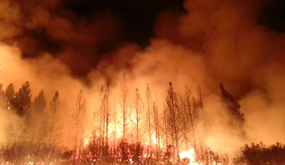
2. Wildfire map
Last year, California witnessed one of the deadliest and most destructive wildfires in its history. A total of over 8,500 fires burned down around 766,439 hectares, the most in any recorded fire season. An interesting thing is that there is a wildfire map that shows the cumulative fires that have taken place in California between 1878 and 2018. According to the map, the majority of areas with vegetation have caught fire during this period. Only the arid deserts in the southeast seem to be exempted from such events. California saw one of its worst wildfires in 2018.
3. 15 million year map
While the previous two maps were about history, this particular one looks into the future — 15 million years from now. California is sitting on the boundary of two giant pieces of Earth’s crust, the North American and Pacific plates, which continue to slowly grind against each other. According to current data, Los Angeles is moving closer to San Francisco by 2 inches every year. This change is imperceptible to us during our lifetimes. But fast forward 15 million years and these small annual changes are going to pile up and California’s western regions might get sheared from the rest of the continent.
Splitting into three
California today is a single state. However, proposals to split it into multiple states have been made in the past. A few years ago, tech billionaire Timothy Draper put forward the idea of dividing the state into three states — California, Northern California, and Southern California.
The new state of California would extend to the coast of Monterey and fold into Los Angeles. Northern California would have included the upper half of the current state, including the city of San Francisco. Whatever is left would make up Southern California. All three proposed states would have roughly the same wealth and population, thereby preventing unpleasant feelings between them.
There is also a movement that asks for California’s independence from the United States. Termed Calexit, support for secession strengthened after the 2016 presidential elections as several anti-Trump supporters were disturbed by his victory.


