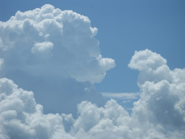
Skygazing has long been a nourishing practice for the mind. When feeling overwhelmed or hopeless, peering into the limitless depths of the sky can help put things into perspective. Whether it be a starry night sky, or the blue sky spotted with clouds, it evokes a sense for the vastness of time and space, namely, awe.
Numerous studies suggest that our sense of well being is enhanced by experiencing awe. With continued and even increasing limits on our lives due to pandemic panic, we may be searching ever more earnestly for a boost from above. On any given day, there is sure to be something spectacular in the sky. These nine unusual cloud formations are worth watching out for.
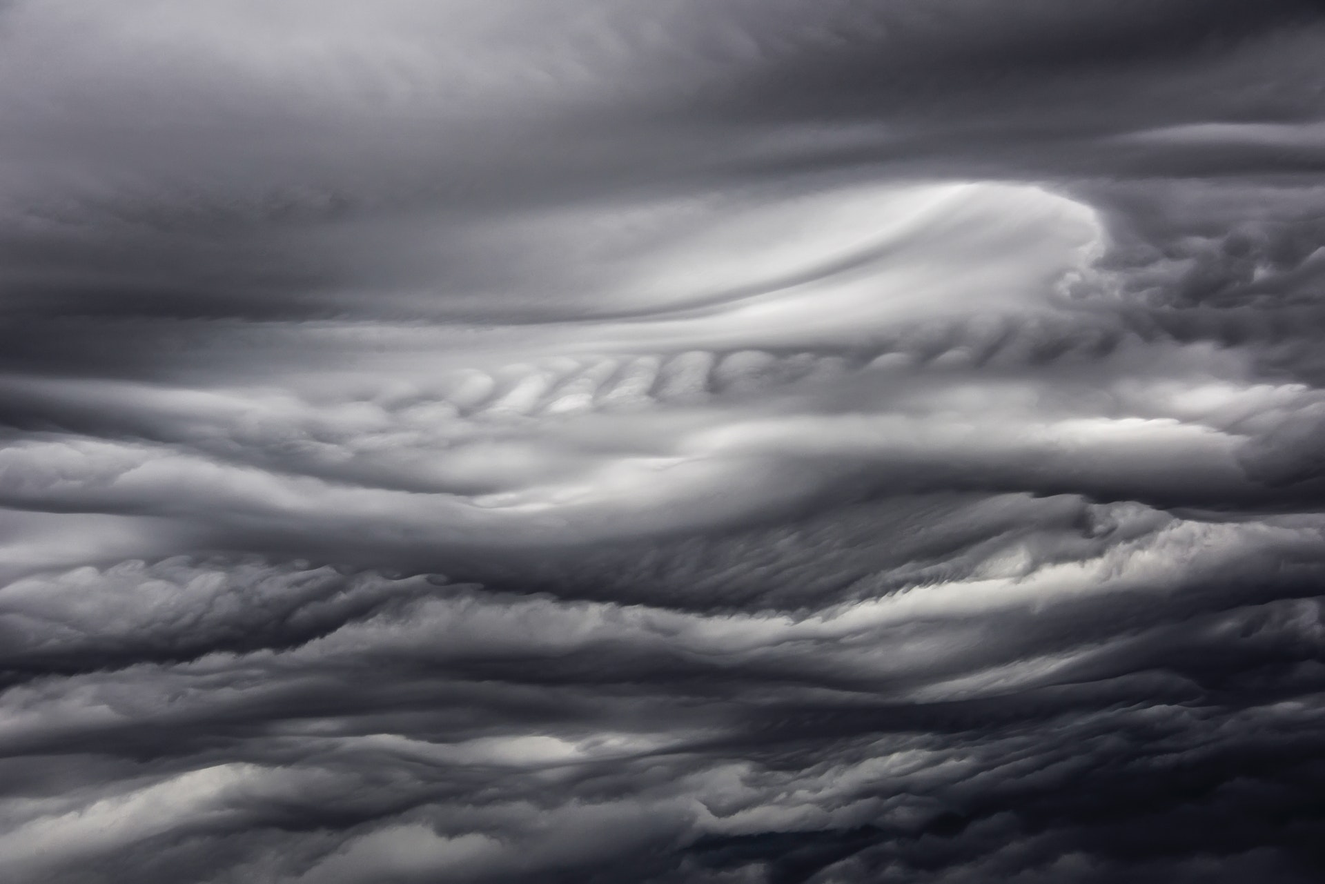
Asperitas
Asperitas is a cloud so unusual that it was not recognized under any of the accepted cloud classifications: cumulus, cirrus, stratus, or nimbus. The identifying characteristic of these rarities is their wild, chaotic pattern on the underside. They can appear to be threatening dark waves in the sky as they follow thunderstorms across the North American plains, yet they vanish before turning into storms themselves.
In 2008, Gavin Pretor-Pinney of the Cloud Appreciation Society proposed the new name “asperatus,” meaning “roughened” or “agitated” for this yet un-named cloud. In June 2015, the modified name of “asperitas” was accepted into the World Meteorological Organisation’s International Cloud Atlas.
Success
You are now signed up for our newsletter
Success
Check your email to complete sign up
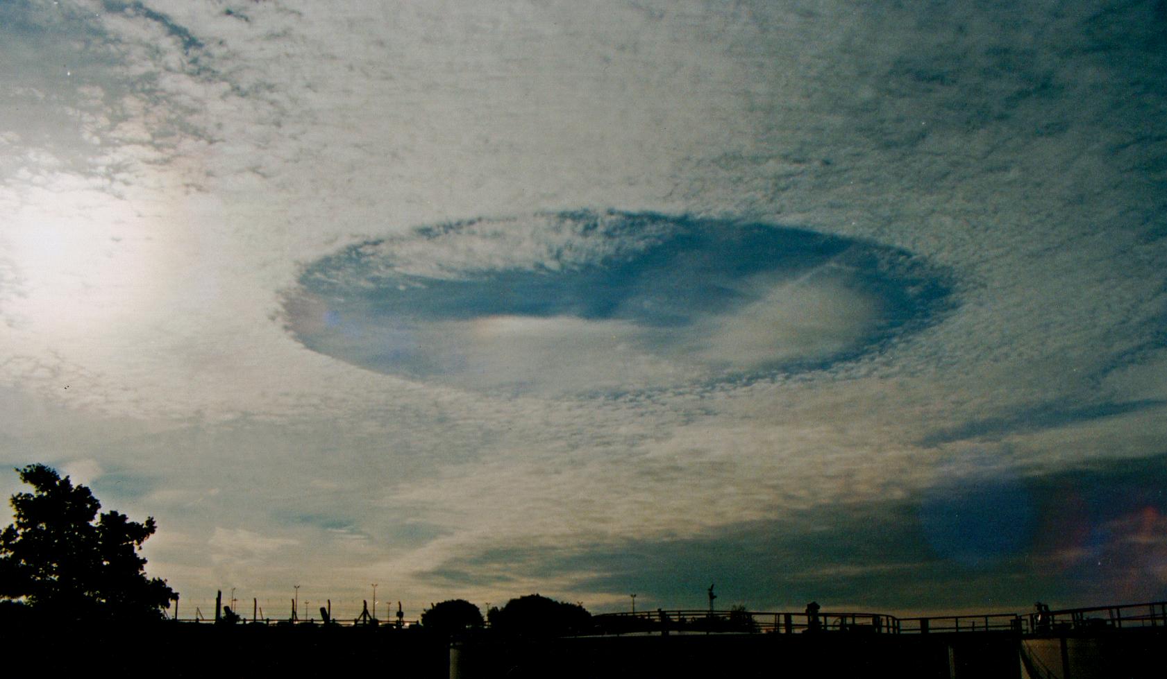
Fallstreak holes
Fallstreak holes start out as puncture wounds in altocumulus and cirrocumulus clouds when an airplane pierces through the cloud layers. These mid to high altitude clouds are composed of water particles much colder than zero degrees Celsius, yet they remain liquid due to the lack of “seed particles” on which ice crystals would form.
The air movement around a penetrating plane is able to generate these necessary particles, which quickly accumulate additional crystals and begin to drop. As ice drops from the area it forms a circular hole in the cloud, which can expand to become a gaping 50km diameter void within an hour.
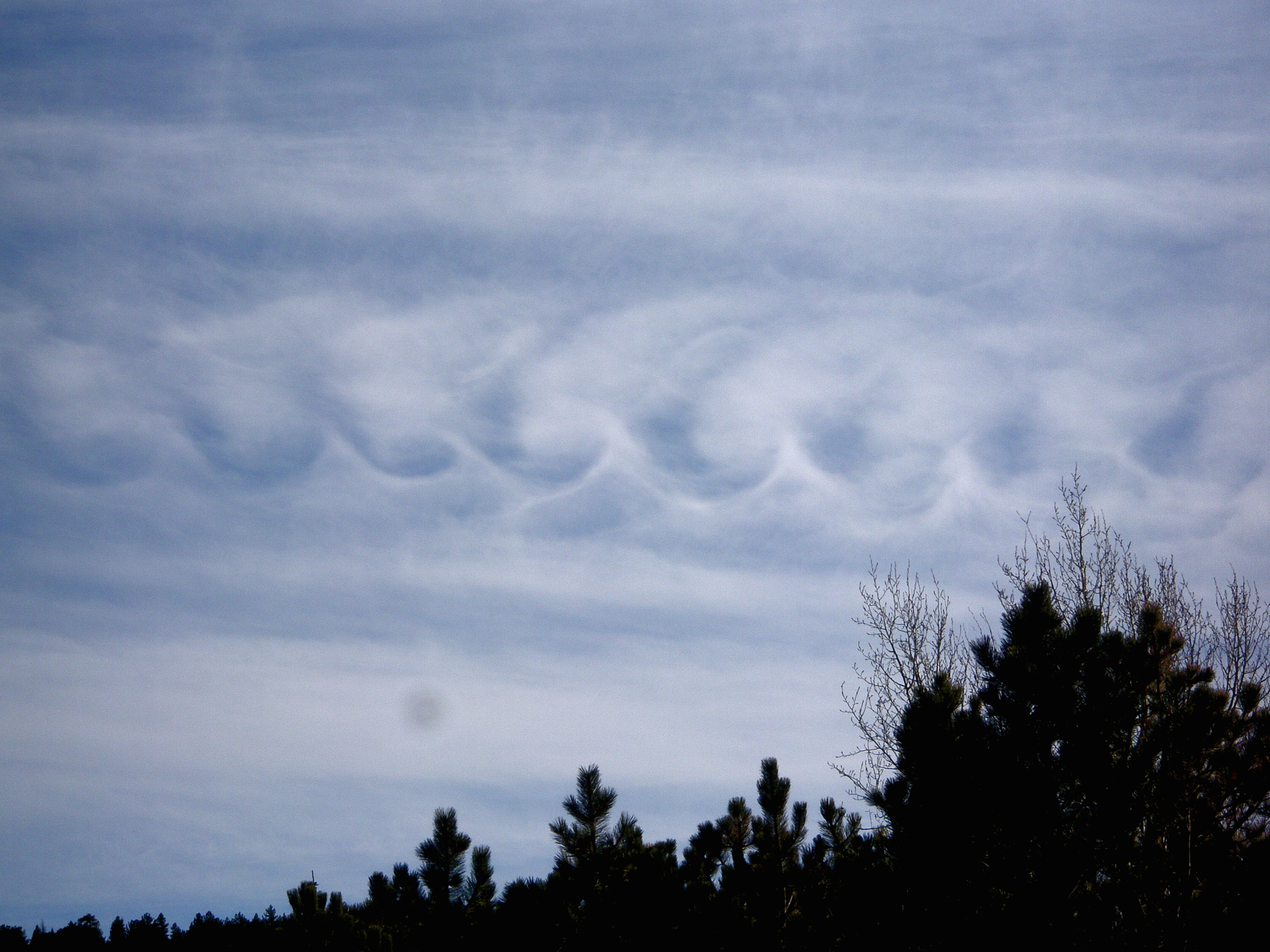
Kelvin-Helmholtz wave
The highest aspiration for many sky gazers, these clouds, named after physicists William Kelvin and Hermann von Helmholtz who uncovered the mystery of their formation, can be seen everywhere in the world, but you must be quick. They only last a few minutes before disappearing.
When swift, warm air that flows over slower, cooler air, it creates a shearing force; which, with the right difference in speed, causes the tops of the denser ripples to roll up, surge forward and tip over in a series of vortices, just like waves breaking in the ocean. Although they are serene in appearance, these waves signify instability in the air and unsafe flying conditions.
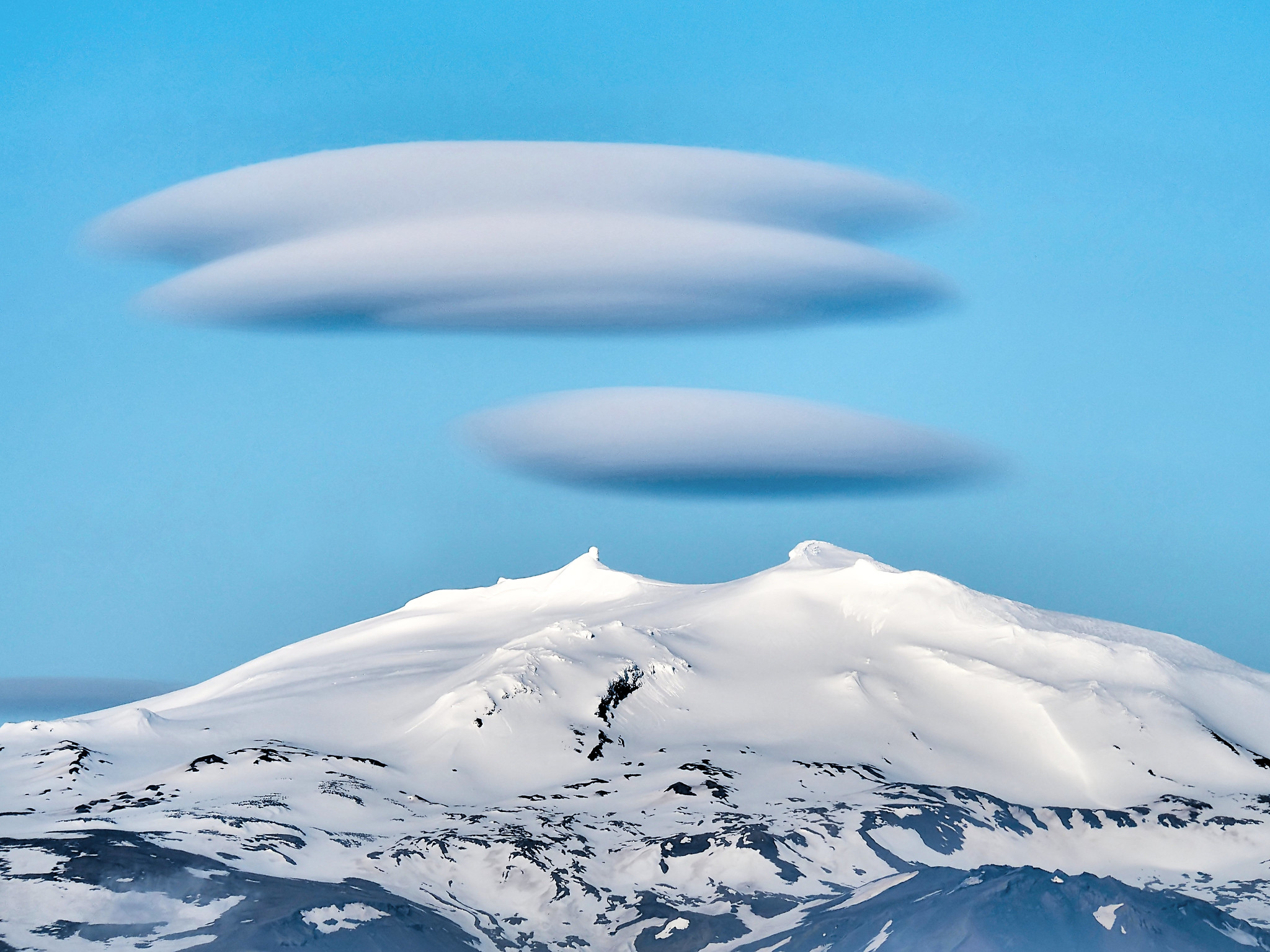
Lenticular clouds
Lenticular clouds are named for their smooth, lense-like shape, formed when stable and humid air streams over a mountain, causing large-scale “standing waves” to form when the air flows down. Moisture in the air condenses to form the lenticular clouds when the temperature at the crest of the wave drops to the dew point.
These clouds tend to hold their form, even as they are blown by a steady wind, making them appear eerily similar to extraterrestrial spacecraft. Some believe these to be an explanation for many UFO sightings.
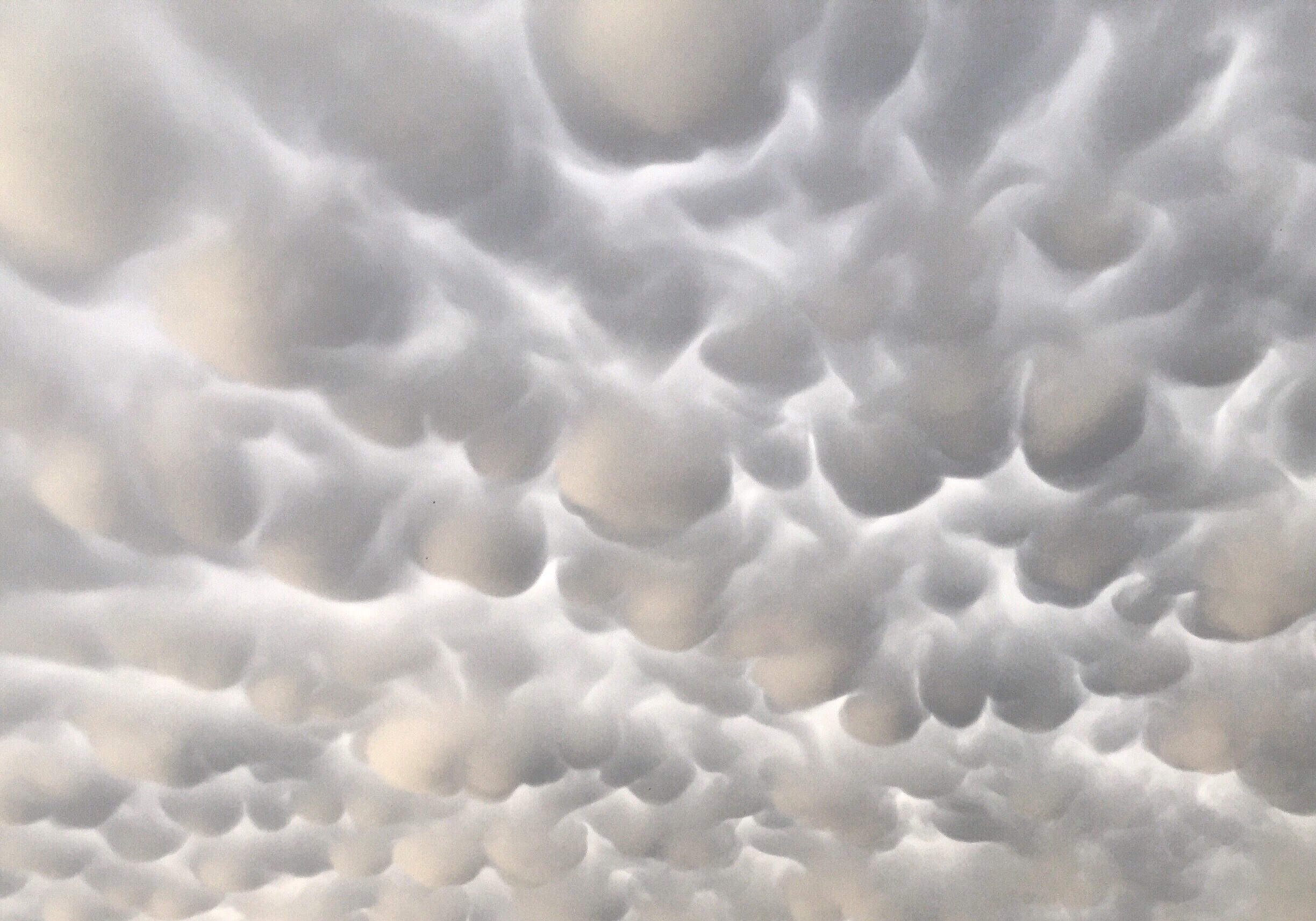
Mammatus
Mammatus clouds formations feature clusters of pouches hanging from the base, with the shapes varying from the classic protruding shape to a long tube hanging from the cloud. These clouds are formed from sinking pockets of cold, moist air, seen from the anvil of a storm or from clouds in a storm’s wake.
A likely explanation for the formation of these clouds is based on “negative buoyancy,” where updrafts carry air dense with ice crystals into air too light to support it. The ice evaporates as it sinks, causing the air around it to cool and sink, thereby pulling the cloud into pouch-like shapes.
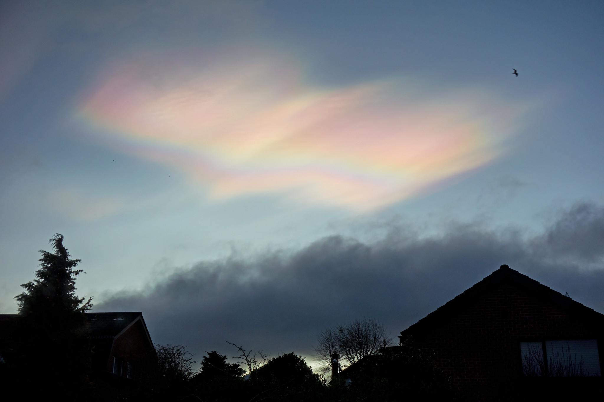
Nacreous
Nacreous clouds are named from the French word “nacré” or “mother of pearl.” These clouds are usually formed at the poles during the winter, when temperatures fall below -83°C at the stratosphere, causing the moisture to condense into clouds of ice crystals.
When illuminated by sunlight, the ice crystals scatter and diffract light, forming the iridescent colors that give the clouds a magical appearance.
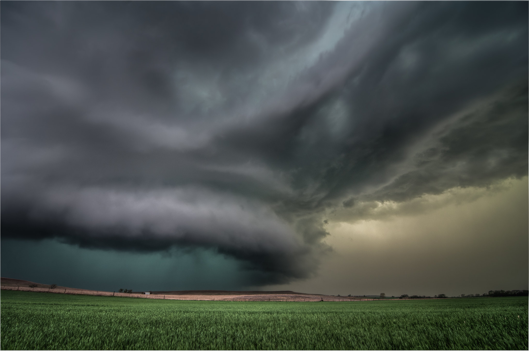
Supercell storm cloud
Supercells are a rare storm cloud associated with tornadoes, with a power rivalled only by hurricanes. A mesocyclone, or continuously spiraling updraft, allows these clouds to sustain a storm for many hours; unlike most storm clouds, where a separation of the updraft and downdraft inevitably weakens the storm in a short time.
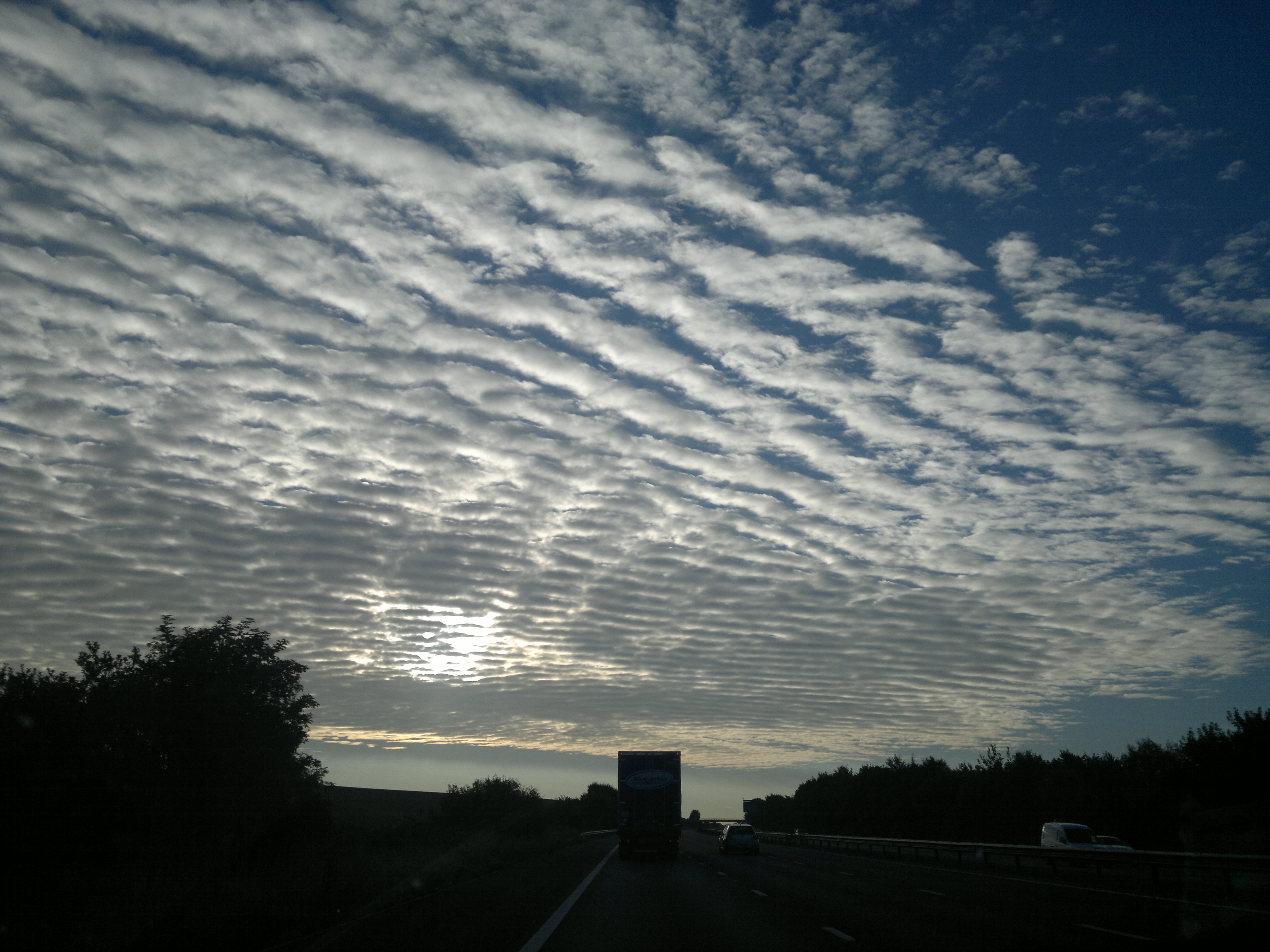
Mackerel sky
Mackerel sky refers to skies of rippled cirrocumulus clouds which can mimic the scales of a mackerel. High in the sky and illuminated by the afternoon sun, a mackerel sky is made up of ice crystals and appears in a pattern of small wispy clouds spread thinly and regularly across the sky.
These clouds can be an indicator of warm winds from a nearby thunderstorm. As the old mariner’s rhyme goes, “Mares’ tails and mackerel scales make lofty ships to carry low sails.” The ripples form when humid air at the edge of a storm system pushes past cooler, resistant air.
Virga
When rain or snow starts to fall, but then quickly evaporates, it forms a sort of dangling effect. Virga, from the Latin word for “branch,” or “rod,” are fanciful clouds reminiscent of jellyfish drifting in the open ocean. When they form at high elevations, they can create very beautiful cloudlets.
Deserts are the best place to see these, as they provide the warm, dry air necessary to quickly evaporate the precipitation. They are a harbinger of heavy rains, however. Even though the air below is too dry for precipitation, the evaporation process cools it, increasing humidity until the conditions are ripe for actual rain or snow.
Whether you are able to catch sight of one of these amazing formations or not, the sky in all its boundless mystery is sure to hold some truth that you are seeking. When we feel that life is too heavily laden with troubles, take a lesson from the clouds. As Jasleen Kaur Gumber observed: “Clouds are on top for a reason. They float so high because they refuse to carry any burden!”