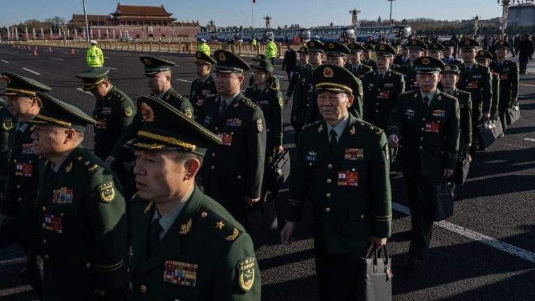
In recent weeks, certain areas in North America, Europe, and China have been subjected to severe weather. The Western United States and Canada were hit by an intense heatwave that damaged roads and rail infrastructure, and hundreds of deaths have been reported.
In Europe, several countries including Germany, Belgium, and the Netherlands have been affected by heavy rainfall and floods. In China, floods ravaged several regions of the Henan province, affecting millions of people. The catastrophic weather that has affected North America, China, and Europe all have one thing in common – the jet stream.
Jet stream
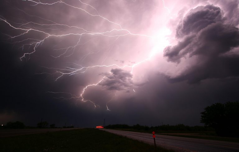
Roughly five to seven miles above the earth’s surface, there is a core of strong winds called the jet stream, which blows from west to east. The air currents are created as a result of cold air from the North Pole clashing with the hot air of the tropical region, creating phenomena like rain, storm, and droughts. The jet stream flows high over the earth and causes changes in the wind and pressure at that altitude.
“This affects things nearer the surface, such as areas of high and low pressure, and therefore helps shape the weather we see. Sometimes, like in a fast-moving river, the jet stream’s movement is very straight and smooth. However, its movement can buckle and loop, like a river’s meander. This will slow things up, making areas of low pressure move less predictably,” according to Met Office.
Weather in high-pressure areas tends to be fair and settled when compared to low-pressure regions, where the weather is likely to be cloudy and stormy. Since high-pressure areas have a thick atmosphere, winds blow outward and air sinks in slowly downwards. As a result, clouds and precipitation are scarce because they are dependent on rising air for condensation.
Success
You are now signed up for our newsletter
Success
Check your email to complete sign up
In contrast, low-pressure areas have a thin atmosphere, which makes the winds blow inward into these regions. Consequently, the air rises upwards, producing condensation and storms. A strong jet stream can affect the strength of a low-pressure region by sucking the air out of the top, lowering the pressure even further, and creating stormier weather.
Disasters
“Jet streams are the weather – they create it and they steer it… Sometimes the jet stream takes on a very convoluted pattern. When we see it taking big swings north and big dips southward we know we’re going to see some unusual weather conditions,” Jennifer Francis, senior scientist at the Woodwell Climate Research Center, said to Bloomberg.
This is what happened with the flooding in Germany. A low-pressure system had positioned itself over the western region, which was followed by heavy rainfall for two days. Subsequently, the rivers overflowed, flooding cities and causing massive damage. Over 170 people have been killed, and hundreds are missing.
In China, a rainstorm brought down a year’s worth of precipitation in just three days in the Zhengzhou prefecture in Henan province. The country’s meteorological department blamed the rainstorm on sustained high-pressure blocks.
The high-pressure blocks, together with Typhoon In-fa, pushed water vapor into the region from the sea. The water vapor then shot upwards, eventually cooling down and returning in the form of a rainstorm. Michael Mann, an atmospheric science professor at Pennsylvania State University, believes that the situation in the atmosphere might have been caused by the weakening of the jet stream.
In North America, a high-pressure system hit the region in June. The fact that the area was already dry exacerbated the situation. The extreme drought in the northwestern areas of the continent ended up creating a bubble of warm air in the atmosphere. Parts of Canada and America have reported wildfires, and energy usage has surged as people have begun to use air conditioners more.
The extreme weather events in North America, China, Europe, Russia, and other countries have made some scientists realize that existing climate models might be becoming obsolete.
In an interview with Financial Times, Michael Mann, director of the Earth System Science Center at Pennsylvania State University, pointed out that current climate models do not reproduce the behavior of the jet stream accurately. He warned that the rise in extreme weather events is “exceeding” predictions.
“I think I would be speaking for many climate scientists to say that we are a bit shocked at what we are seeing… There is a dramatic change in the frequency with which extreme [weather] events occur,” Chris Rapley, professor of climate science at University College London, said to the media outlet.