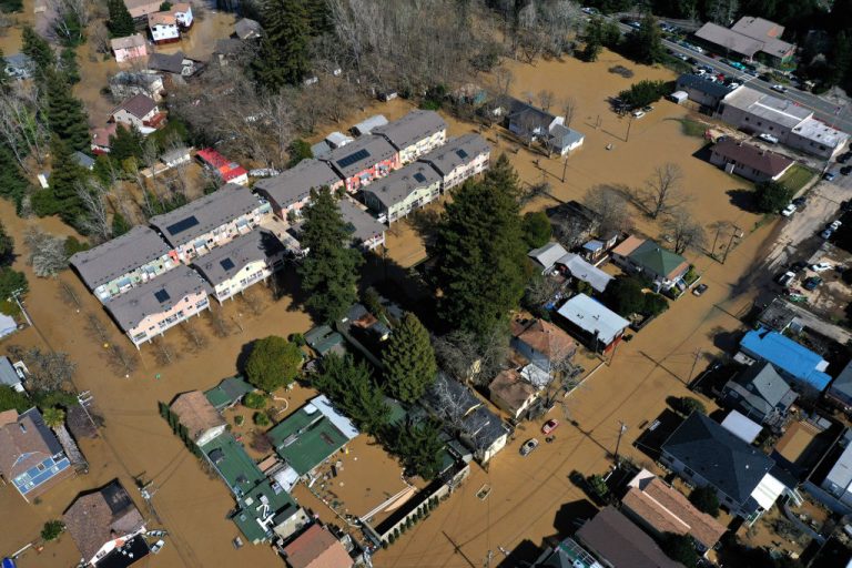
California is bracing for a potentially devastating weather event on Sunday, Oct. 24, which could bring upwards of a foot of rain to drought- and fire-stricken areas in the central and northern parts of the state as well as up to three feet of snow in the Sierra Nevada.
Over the weekend and into early next week, California is expected to experience a series of storms due to atmospheric rivers (AR) moving into the region from the Pacific.
An AR is a narrow corridor of concentrated moisture in the atmosphere typically a few hundred miles wide and several thousand miles long. At any given time there are three to five of these narrow plumes present within the atmosphere.
The amount of water these rivers carry is gargantuan. A single atmospheric river can carry as much water as the world’s largest river, the Amazon River.
Marty Ralph, director of the Center for Western Weather and Water Extremes (CW3E) at UC San Diego, told CNN that “an atmospheric river marked as a category 4 or a 5 is capable of producing remarkable rainfall totals over three or more days, likely to exceed 10-15% of a typical year’s precipitation in some locations.”
Success
You are now signed up for our newsletter
Success
Check your email to complete sign up
In February 2019, the CW3E released a five-level scale to categorize the intensity of atmospheric rivers. The scale was developed by Marty Ralph and Jonathan Rutz from the National Weather Service as well as other experts.
The atmospheric river moving into California over the weekend is categorized as a level five, the highest level on the scale.
According to a CW3E outlook, “The strongest AR is forecasted to make landfall across Central and Northern California on Saturday, potentially bringing AR 4/ AR 5 conditions to the San Francisco Bay Area.”
Several AR’s are forecasted to hit the area with the first two having the potential to produce upwards of 5-inches of rainfall in portions of Northern California and southern Oregon. “A fourth AR is forecasted to bring widespread precipitation to much of the western US, with the heaviest precipitation amounts in Northern California,” the CW3E stated online.
Too much, too fast
While much of the western United States has been experiencing widespread drought the level of precipitation expected may be too much too quickly and do little to resolve drought conditions.
“There are cautious hopes that the coming rains will bring relief and reduce fire risk in the state’s parched regions, but they’re not expected to end the drought,” the Los Angeles Times reported.
Emily Heller, with the weather service’s Sacramento station told the Los Angeles Times, “Unfortunately, two years of drought — one storm is not going to fix it.”
The storms have the potential to cause flash flooding as well as landslides and debris flows in areas that were just hit with devastating wildfires. Areas threatened include Greenville, Highway 70 and the cities of Quincy, Chester and Paradise.
As little as 0.7 inches of rain has the potential to trigger a debris flow. Officials are “moderately concerned” about the area that was recently inundated by the Alisal fire in western Santa Barbara County.
Beginning Friday, wind gusts between 40 and 50 mph are expected in some Southern California mountain and desert regions and high surf and dangerous rip currents are currently being observed along Central Coast waters. Officials expect the hazardous conditions to last through to Tuesday night.